Mile By Mile River Guide for Kaweah River Rafting
 This
mile-by-mile guide is a simple overview of the rapids on the commercially-run
section of the Kaweah River. As with all California white water rafting
trips, you should obtain more specific rapid information before running
the river on your own. This guide is not intended to take the place of
real-life river running expertise.
This
mile-by-mile guide is a simple overview of the rapids on the commercially-run
section of the Kaweah River. As with all California white water rafting
trips, you should obtain more specific rapid information before running
the river on your own. This guide is not intended to take the place of
real-life river running expertise.
Mile 0-- Private boater put-in access at the bridge near the Gateway Restaurant. Put-in beneath the bridge on the left bank. The bank is steep and parking is limited. The East Fork of the Kaweah enters just upstream on the left.
Mile 0.1, Gateway Rapid (Class IV+)-- A 250-yard boulder slalom. There are many holes near the bottom of the rapid.
Mile 0.5, The Chute Rapid (Class IV)-- A hearty ten-foot drop. There is a river wide hole approximately thirty feet before the main drop.
Mile 0.8, Osterizer Rapid (Class IV+)-- Lots of holes and boulders on the right side. Near the bottom, the river bends to the right. Several holes stretch across the river here but those on river left are less intimidating.
 Mile 0.9, Commercial Put-in-- Commerical rafting companies put-in
at this private area on the left bank.
Mile 0.9, Commercial Put-in-- Commerical rafting companies put-in
at this private area on the left bank.
Mile 2.0, Lithium Rapid (Class IV)--The river bends to the left
here. A few yards after the entrance, there is a rock in the center of
the channel. The rest of the rapid is boulder-strewn. Pick a slot wisely.
Mile 2.6, Powerhouse Rapid (Class IV+)-- This is a possible portage at lower flows due to a rock blocking the channel. There are two islands separating the river into three channels. Scout on the island dividing the right and center channels.
Mile 2.8, Cyanotic Rapid (Class IV+)-- This is the longest rapid on the river. The entrance is hindered by several boulders, as is the lower section of the rapid. At low water, the right side gets very sticky.
Mile 3.1, Dinely Bridge-- This is a put-in point. Mind the "no trespassing" signs by staying close to the bridge. You may not leave your vehicle at this access point.
Mile 4.6, Suicide Falls Rapid (Class IV)-- A Class II entrance disguises a severe river-wide ledge. There is a sneak route to the left of the ledge at higher flows.
Mile 4.7, The Chair Rapid (Class III+)-- A rock just right of center creates a large hydraulic that feeds diagonally to the left bank.
Mile 5.7, The Slickies (Class IV)-- This rapid has two parts which are approximately fifty yards apart. The first half is known as Upper Slicky-- a center chute between two flat slabs of granite. Lower Slicky is a shallow slide which empties into a strong reversal. This reversal flushes only to the left and has been known to hold a kayak for five minutes.
Mile 8.1-- South Fork of the Kaweah enters on the left.
Mile 9, Holiday Hole Rapid (Class IV)-- The length of this rapid
depends on the level of Terminus Reservoir. The river bends to the right,
and then drops into a violent hole. The hole can be averted to the left.
The rest of the rapid is a boulder slalom.
Mile 10-- Take-out at the boat launching area in Terminus Reservoir.
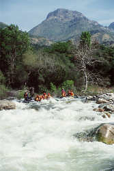
Images courtesy of All-Outdoors
California White Water Rafting.
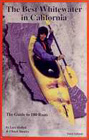
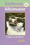
California White
Water by Jim Cassady and Fryar Calhoun was used as a reference book
when writing portions of www.Kaweah-River.com.